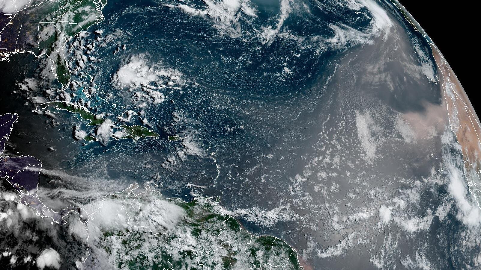
A developing Super El Niño and massive Saharan dust plumes have pushed the Atlantic hurricane season's quiet period through at least mid-August, giving Palmetto Bay and Cutler Bay residents additional days to finish storm preparations before peak season begins.
WPLG meteorologist Michael Lowry reported Thursday, Aug. 6, that a band of wind shear stretching across the tropical Atlantic has created a barrier blocking potential storm development. That shear is driven by the rapidly intensifying El Niño, which has already warmed central and eastern Pacific waters more than 2 degrees Celsius above average. Most computer models suggest it could become the strongest El Niño in modern records.
Meanwhile, large masses of dry Saharan air are rolling off Africa and settling over the zones where early-August tropical systems typically form. The combination has made the Atlantic exceptionally hostile to hurricane development. In July, Caribbean wind shear hit its highest level on record since 1979, according to Lowry.
As we reported July 29, forecasters initially expected the calm to last through the first two weeks of August. Thursday's update extends that window more precisely through mid-August.
One possible system, low odds
Long-range models hint at a possible weak tropical system forming around the weekend of Aug. 15 over the open Atlantic between Africa and the Caribbean. The probability sits at roughly 10%, and forecasters say long-range outlooks do not favor any eastern Atlantic system making a transatlantic crossing toward South Florida this season.
Below-normal season, but not zero risk
Colorado State University's Wednesday, Aug. 5 seasonal forecast, its fourth consecutive downward revision since April, projects nine named storms, four hurricanes and one major hurricane for 2026. That's about 40% of an average season's activity. CSU has now lowered the probability of a major hurricane striking the U.S. East Coast, including the Florida Peninsula, to 7%, compared to a historical average of 21%.
"That's not to say we won't see anything," CSU lead forecaster Phil Klotzbach told the Miami Herald on Aug. 5, when the university released its final seasonal outlook. "I want to be careful because a lot of people have written off the season, but you have to keep your eyes to the sky and pay attention to things, especially in the subtropics."
What residents should do now
The statistical peak of hurricane season falls on Sept. 10, and the most dangerous stretch runs from mid-August through mid-October. That means the current calm is a narrowing window, not an all-clear.
Miami-Dade County recommends stocking a seven-day supply of non-perishable food and water at one gallon per person per day, including pets. Residents can look up their evacuation zone using the county's Storm Surge Planning Zone Finder at miamidade.gov. Those who need specialized transportation or medical monitoring during an evacuation can register for the county's Emergency and Evacuation Assistance Program by calling 305-513-7700 or dialing 311.
Sign up for Miami-Dade Alerts and download the Ready Miami-Dade app for real-time emergency notifications. Miami-Dade Emergency Management can be reached at 305-468-5400.




.jpg)