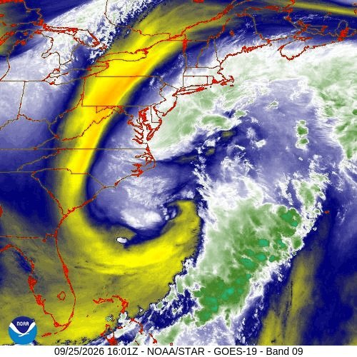
A nor'easter is pushing rough seas and drier air into South Florida through Sunday, Sept. 27. Palmetto Bay and Cutler Bay residents get a rain break, but coastal hazards are elevated along the Miami-Dade shoreline.
The National Weather Service (NWS) Miami said on X Friday, Sept. 25, that the storm system's circulation has pushed drier air across the peninsula, keeping rain chances low Saturday and Sunday.
The tradeoff is high seas and dangerous surf. The NWS reported hazardous marine conditions will continue through Sunday, with a high risk of rip currents in effect for all Atlantic beaches. Seas of 5 to 10 feet are expected across Atlantic waters, NBC Miami reported. Red flags are likely at beaches and small craft advisories remain in effect.
Minor coastal flooding is expected along the Miami-Dade coast, according to the NWS Miami forecast office. Low-lying coastal areas could see saltwater flooding within 1.5 to 2 hours of high tide. The agency warned residents not to drive or walk through saltwater flooding.
King tides are compounding the problem. High tides along the Atlantic coast will be elevated through the weekend of Sept. 26-27 and possibly into the following week, the NWS said, increasing the risk of saltwater flooding in low-lying, poorly drained coastal areas.
Sammy Hadi, lead meteorologist with the National Weather Service in Miami, told the Sun Sentinel that Sunday looks like the driest day. "It doesn't get much better than this in September," Hadi said.
The NWS forecast for the Cutler area calls for a high of 87 degrees Saturday with scattered thunderstorms possible, then 85 degrees Sunday with increasing clouds.
Rain chances are expected to climb back to the 60% to 80% range by Tuesday, Sept. 29. Residents can check beach conditions and flood advisories at weather.gov/mfl.






.jpg)